This page will mostly contain images. You can click on the photos to zoom in, or open them in a new tab (or save them to your machine).
Do note that these full-res photos can be up to 6000x4000 in size and can reach up to 20MB. If you’re on a metered connection, this may be an important consideration. The thumbnails are compressed for your browsing.
Feel free to download these photos! These are under the WTFPL.
If locations are specified, you can find the latlong values or Google Maps links below.
At Batan (South leg)
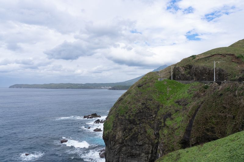
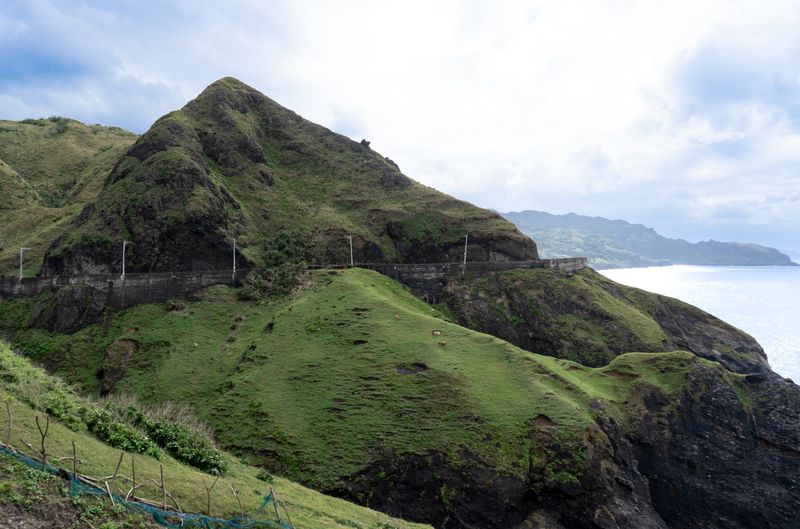
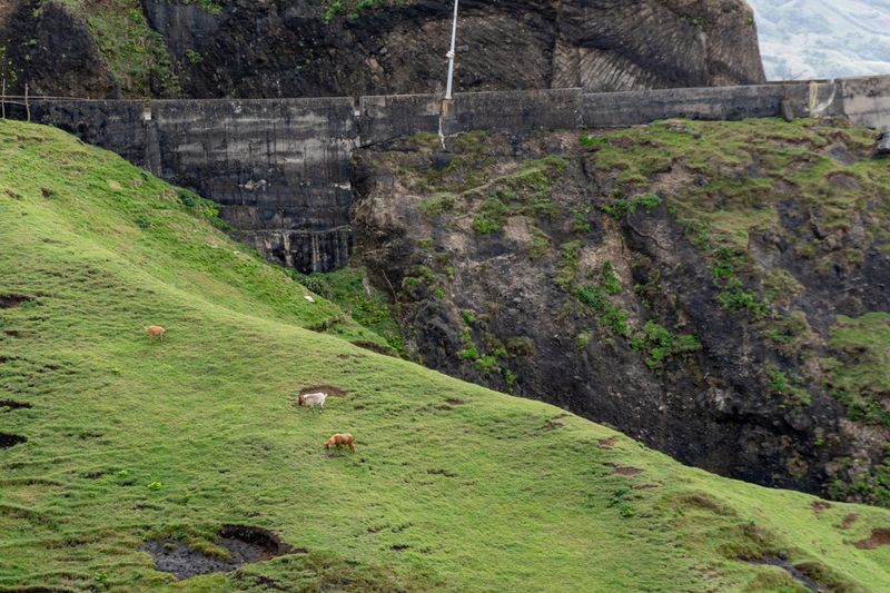
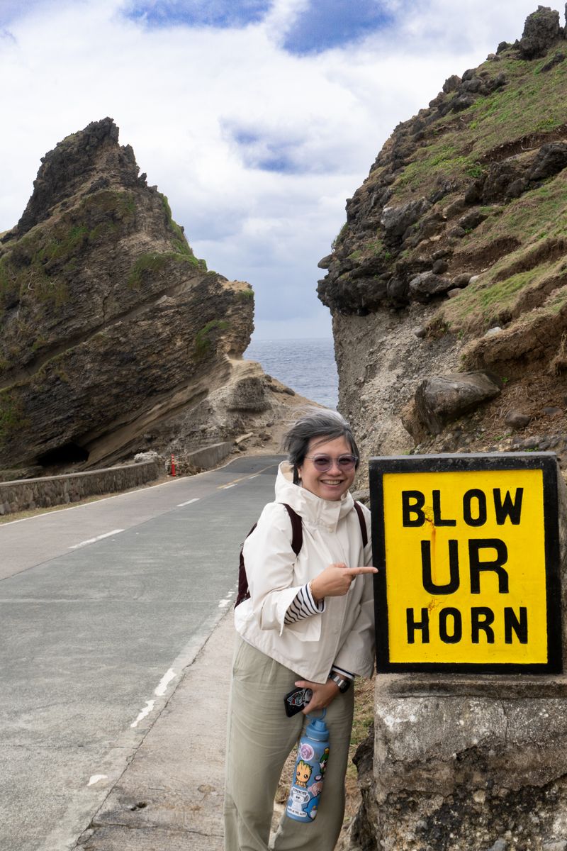
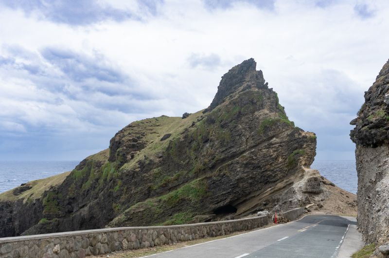
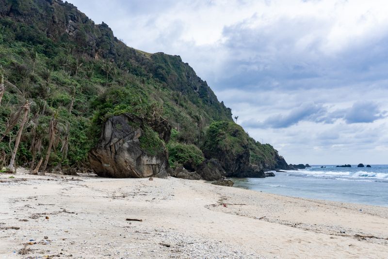
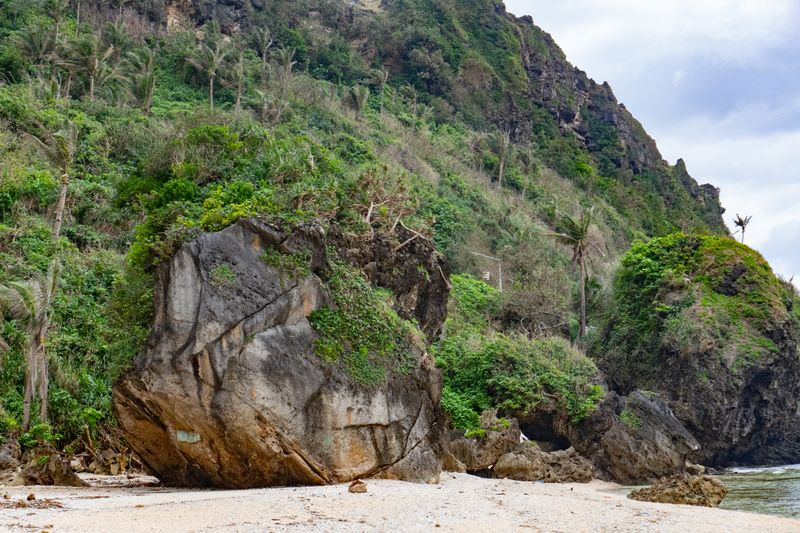
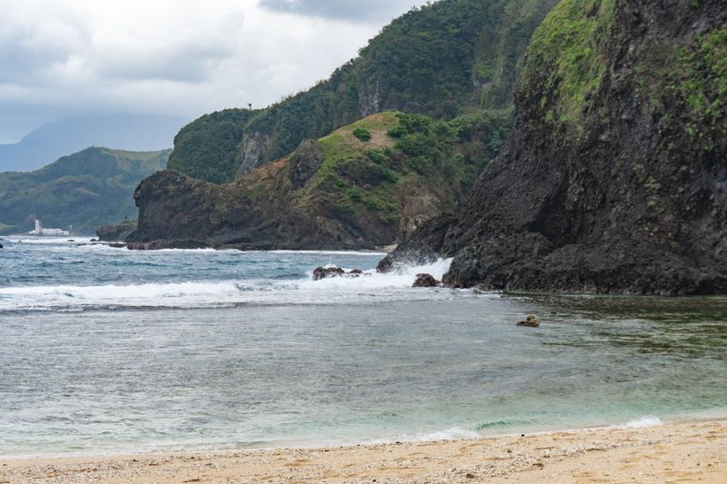
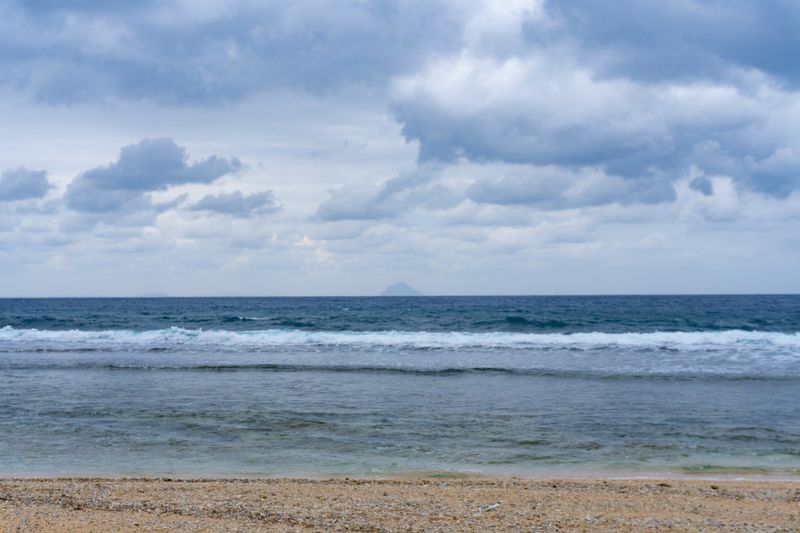
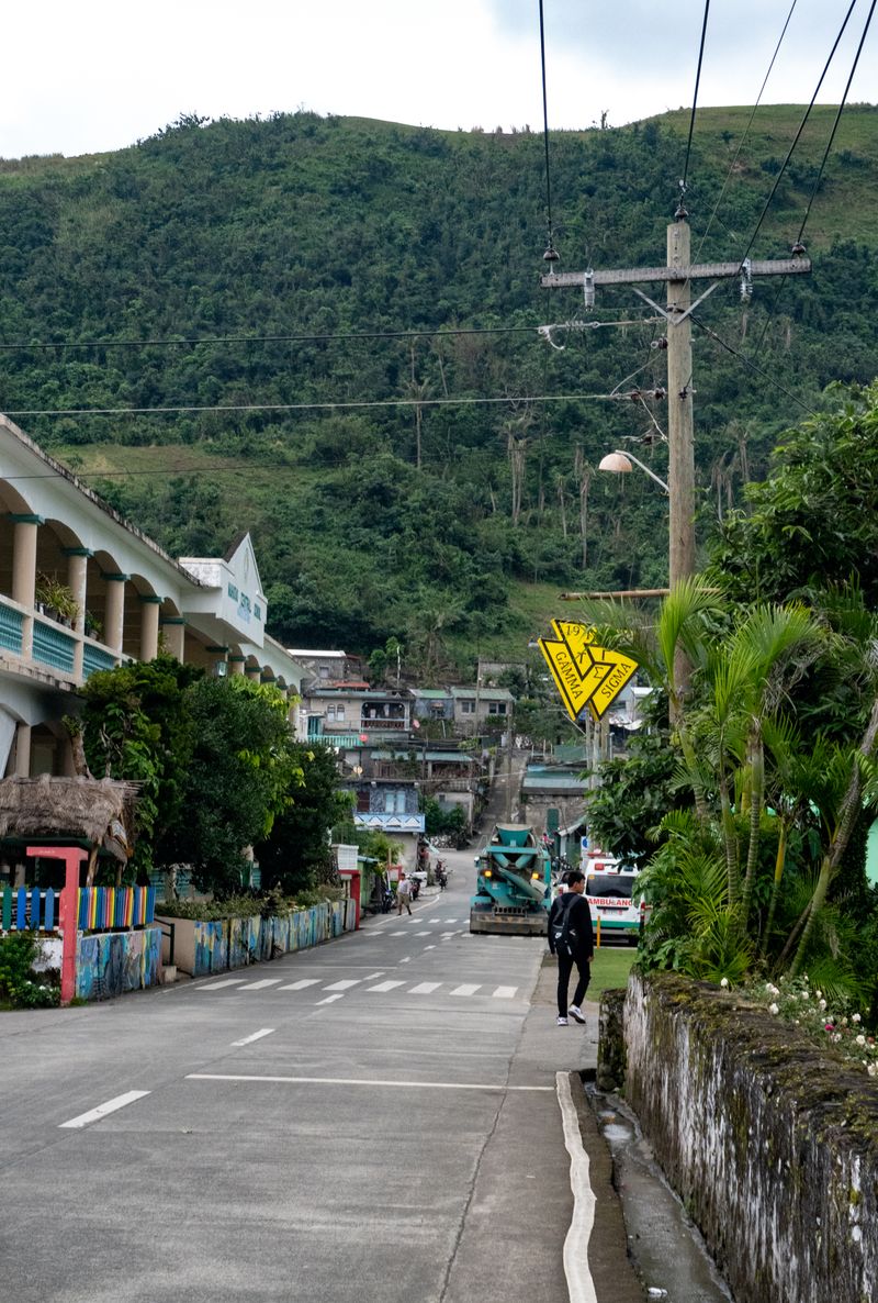
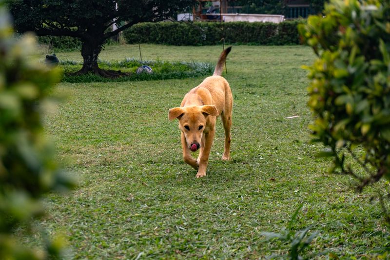
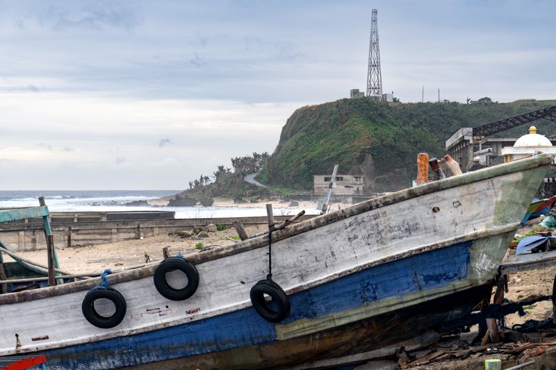
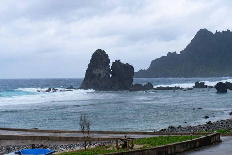
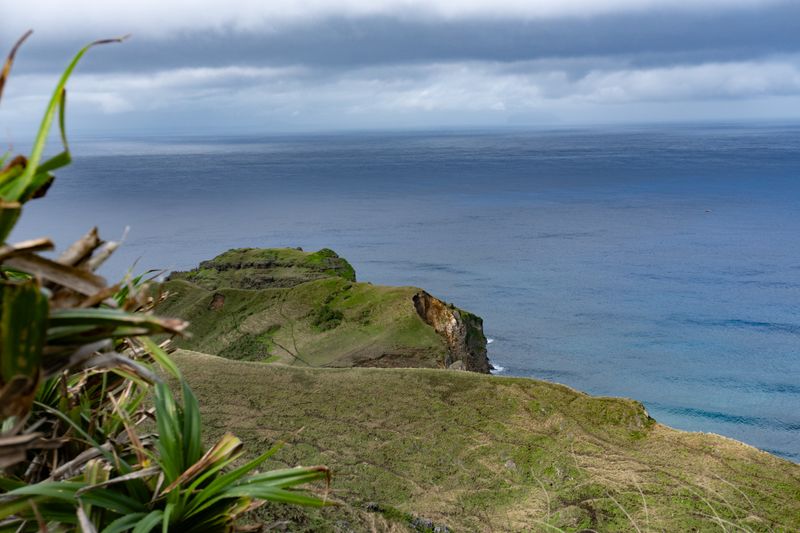
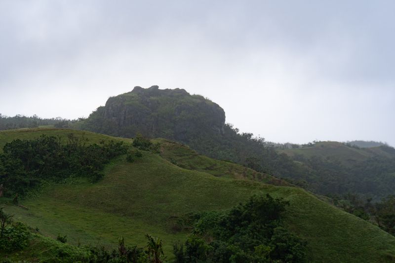
Basco port.First meal at Basco. Some lumpiang Shanghai with a simple soup.Cliffside with Basco and Iraya peeking through. Taken from Chawa Viewing Deck, facing North.Goats along the hillside, with a sharp drop going to sea. Also taken from Chawa Viewing Deck, facing South.The goats, up-close.A rare sight of Iraya. Our tour guide (Manny) mentioned mount Iraya is barely seen, even in fair weather. Taken near Rakuh A Payaman.My mom at the Alapad rock formation. Fascinating tilted strata. "Blow your horn" is a common sign in Batanes due to cliffside blind spots.The formation by itself. Note its visible layers.House of Dakay, the oldest Spanish colonial-era house in Ivana, from 1877. Note the person inside—the house still serves as a functional dwelling.Boulders at Maydangeb White Beach. The boulders which seem to blend with the cliffs in the background are larger than the palm trees. They might be chipped off from the same cliffs through erosion rather than directly expelled via an eruption from Iraya.A closer look at the boulder.Waves crashing at Maydangeb. Basco and Iraya can be barely seen on the left.Dinem Island peeking through the horizon. Taken from Maydangeb.Life as usual in Mahatao. The Triskelion of Tau Gamma Phi reaches even the remote parts of the Philippines. With a 2024 population of ~1,700, even 50 members would mean there would be one Triskelion out of 50 in the town. Taken in front of San Carlos Borromeo Parish Church.Kind dog who followed me all the time in Mahatao. Manny mentioned the dog's lineage has been a faithful mainstay of the parish.
At Sabtang
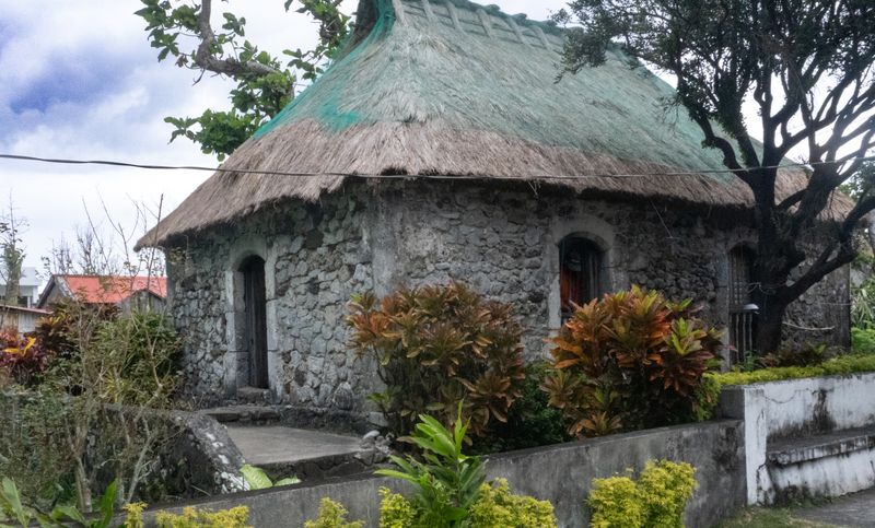
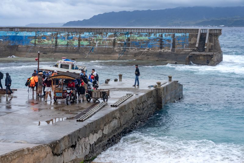
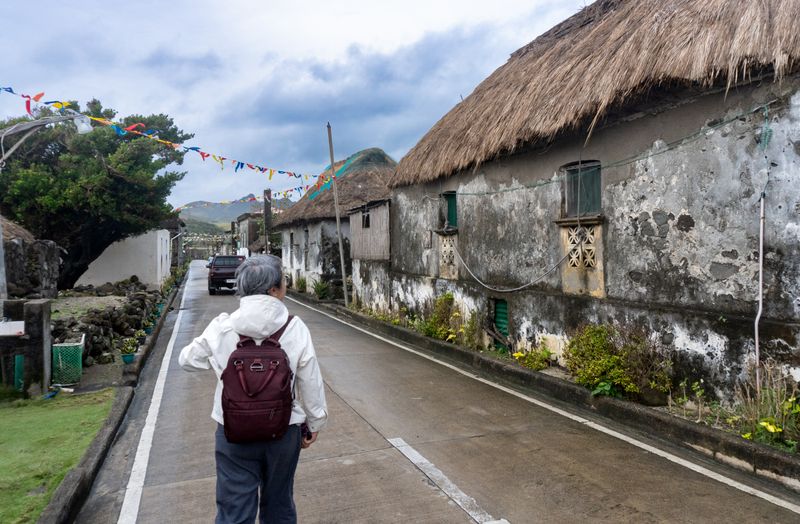
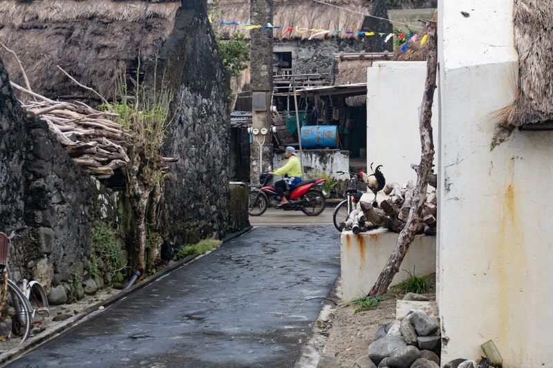
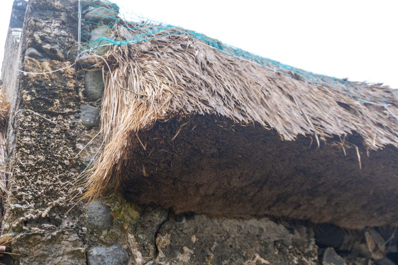
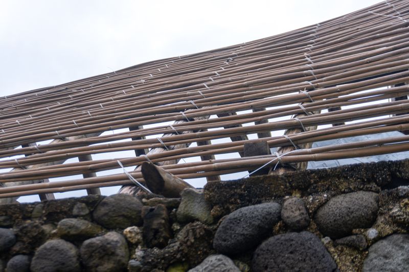
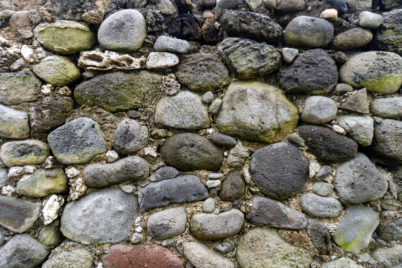
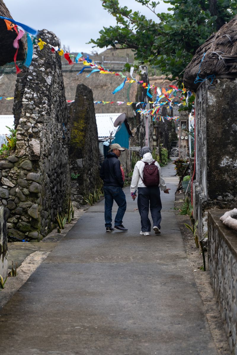
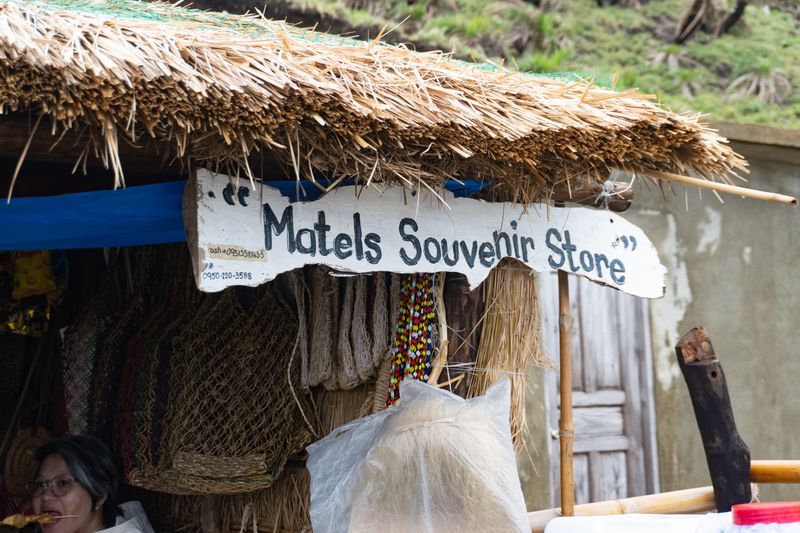
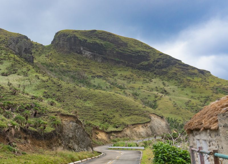
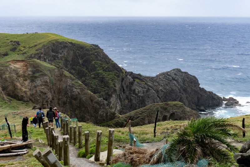
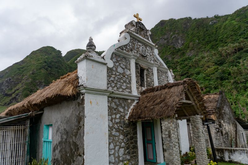
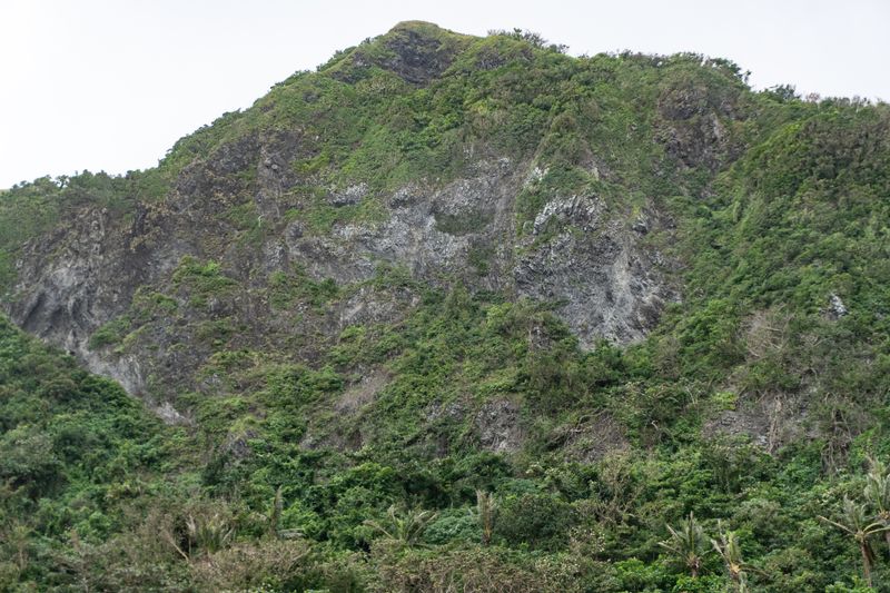
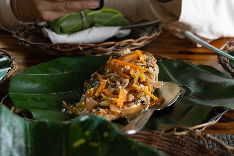
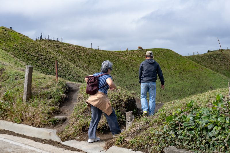
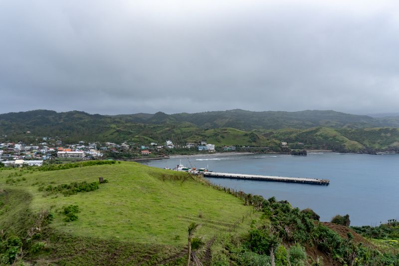
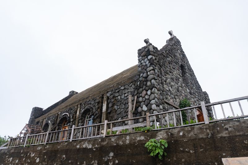
Arriving at Sabtang Port. Even in fair weather, waves will regularly get up to a few metres high. The cliff faces are easily twenty meters in height. There are barely accessible shores in Sabtang, much less so in Ivatan which we did not get the pleasure to visit.The port itself, with the small ferry still unloading. Tricycles and motorcycles are the main mode of transportation here, and gas prices are fixed and don't follow the usual fare. Batan is seen in the distance. The seawall behind it has since been significantly damaged half a year later, in September 2025.A beached ferry. An active construction site can be seen on the right, as well as a communications tower in the background. Taken near Sabtang Port.Entering the Savidug barrio. The kugon-roofed houses are actively in use; and a fiesta was just held a day or two prior (hence the banderitas). Note the pickup truck—arguably one of the rarest sights in Sabtang.An alleyway in Savidug. A more modern rendition of the stone house is seen on the right. Under the white paint and concrete plaster, they are still made out of cobblestone. On the left, it is unclear whether those are destroyed or unfinished houses.A close-up of the kugon roofing. Note how thick the material actually is.The roof frame without the kugon.A close-up of the cobblestone texture of the walls. Note the variety of the stone and what seems to be some sort of concrete filler that makes it look like a conglomerate.Manny and my mom down the alley in Savidug.An ijang, seen dead center, in Savidug. These are hillfort settlements dated to at most the twelfth century CE. See notes below.My mom serendipitously caught eating in the corner. Matel's Souvenir Store is a roadside establishment on the way to Chavayan.Pancit habhab, Ivatan-style. Completely zero-waste, as it's eaten on a breadfruit (locally called "kabaya") leaf.A rock formation on Sabtang, just outside of Matel's. Interesting to speculate how it formed through the "sands" of time. See the diagonal stratification on the rock.The apparently famous viewpoint outside Matel's. We opted to skip the short hike due to bad weather and the other incoming tourists, who can be seen in this photo. Note the lack of clear sedimentary strata in the rock—this is relatively younger igneous rock.Santa Rosa de Lima Chapel in Chavayan. Note the integration of the kugon roofing, and the cobblestone masonry of its facade. What seems to be a version of the Dominican Cross (the circular emblem) can also be seen.The "kissing rocks" formation. The rock seems to be similar to the boulders in Maydangeb beach. Wonder how they got there?Cliff face behind Chavayan, to the North. Compared to Batan, seems to be igneous and volcanic.Prepping for departure in Sabtang Port going back to Batan. Later, it will rain hard, and winds will blow up to sixty to eighty km/h. Signal No.2 for the rest of the country, but a regular occurrence for the Ivatans.Final meal before departing in rougher seas. A sort of a local fish, served on the distinctive kabaya leaf.
Notes
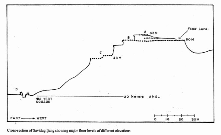
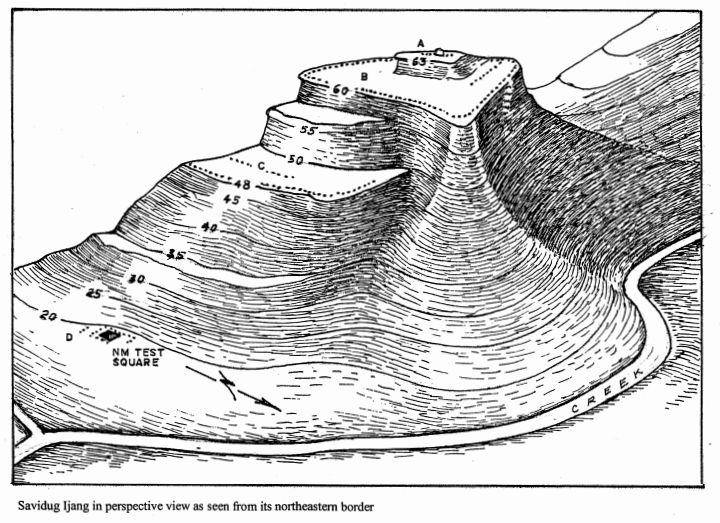
Savidug Ijang
The Savidug Ijang is noted to have “remarkable similarity” with Zakimi Gusuku in Okinawa. The twelfth century CE dating of the site comes from Song (or Sung) dynasty era ceramics recovered from the site.
… the artefactual materials recovered from the Savidug Ijang, such as the Sung-type ceramics and Chinese beads of the 12th century AD, fit perfectly well with the timing of the foundations of the Okinawan castles, beginning from circa AD 1200. In fact, there are indications that the local potters imitated certain Sung-type ceramics, as evidenced among the earthenware sherds we retrieved.
Archaeology of Batanes Province, Northern Philippines: The 1996-1997 Status Report
The paper’s PDF is referenced in the Ijang Wikipedia page above, but I’ll also provide it here.
At Batan, again (North leg)
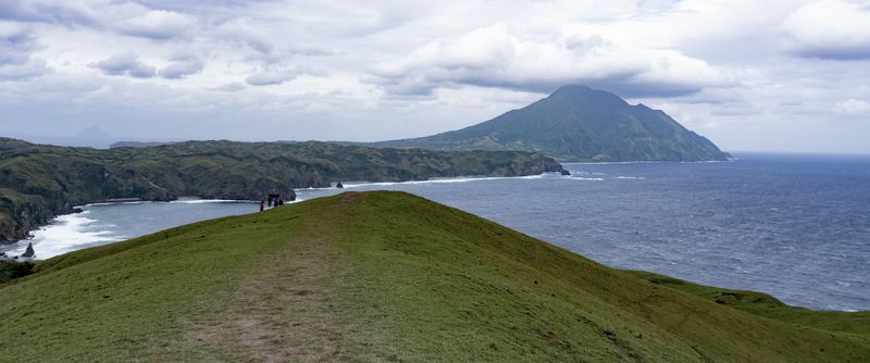
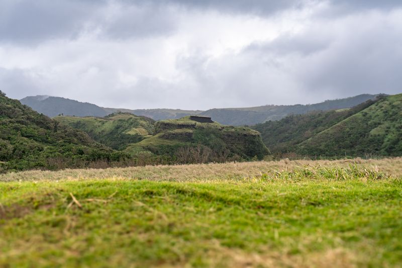
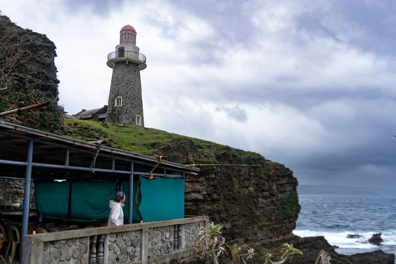
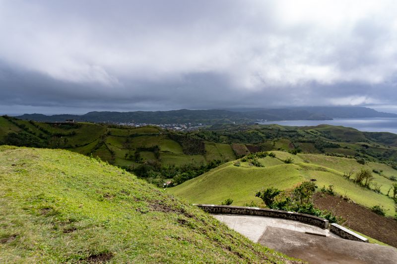
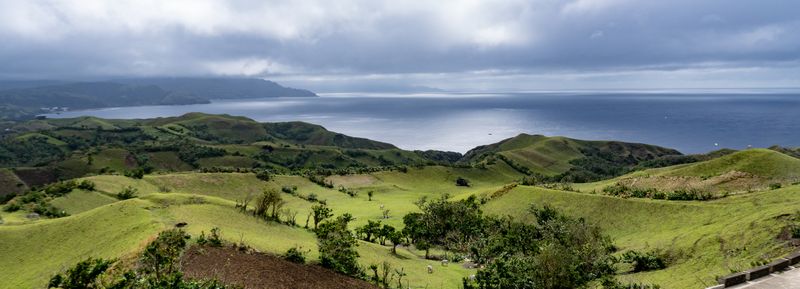
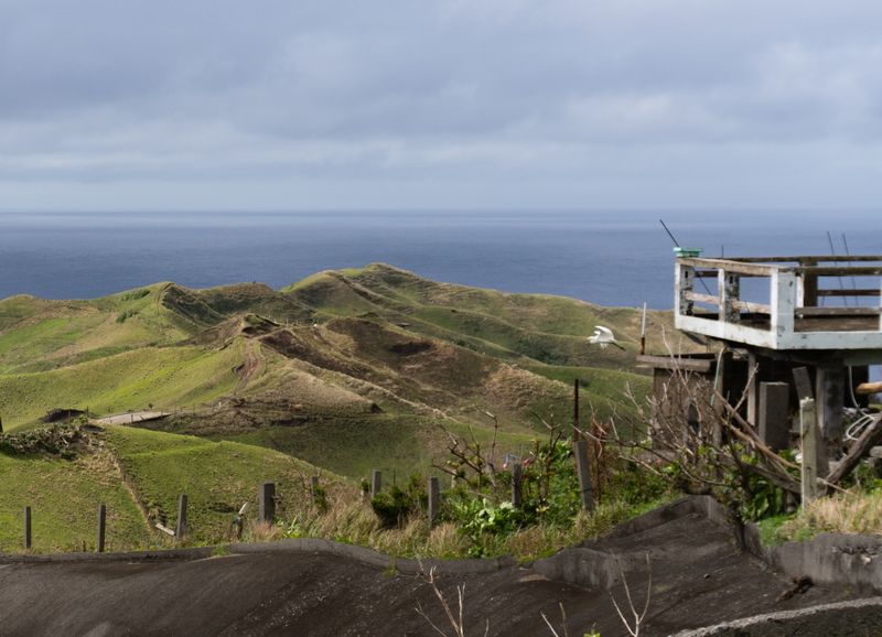
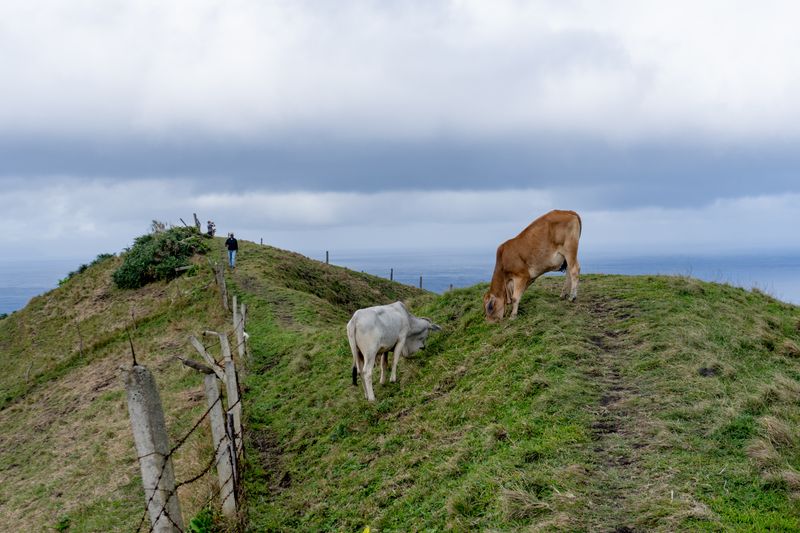
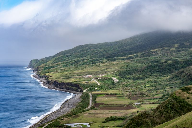
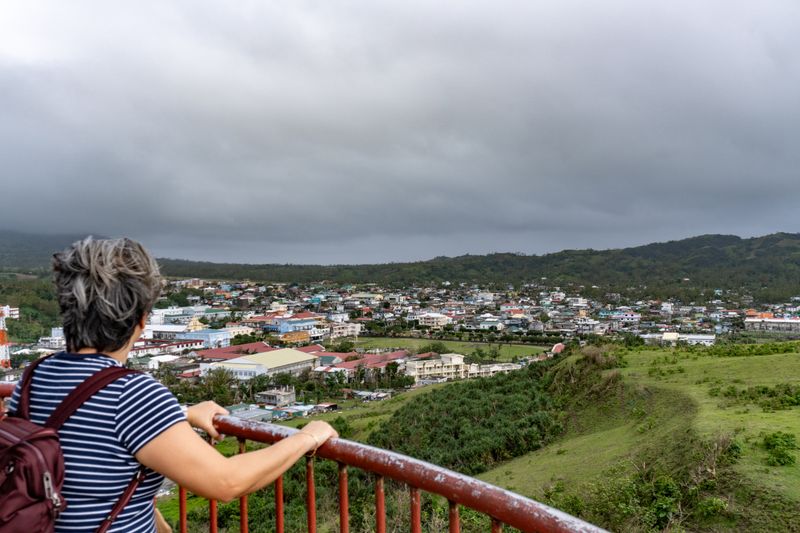
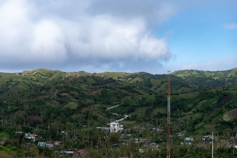
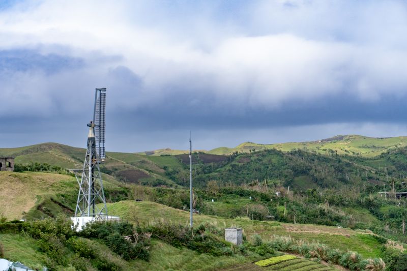
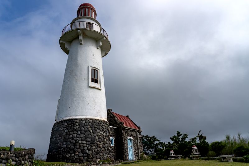
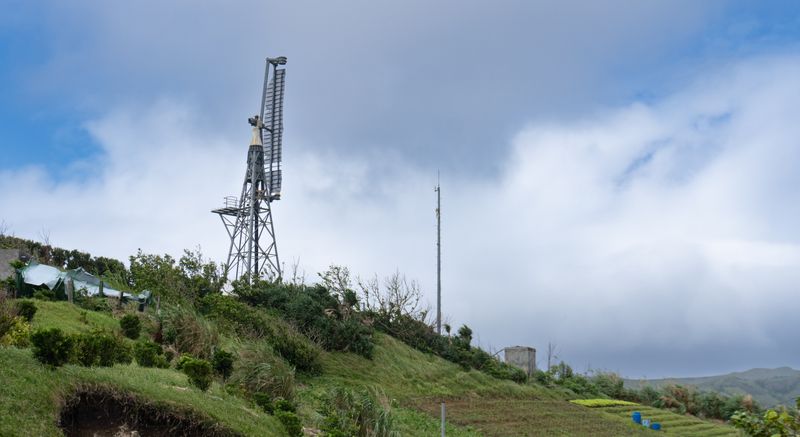
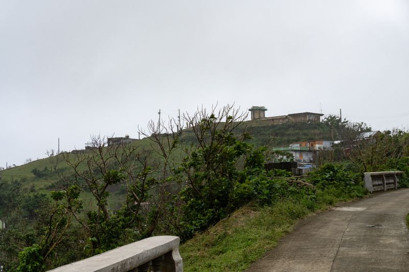
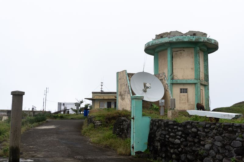
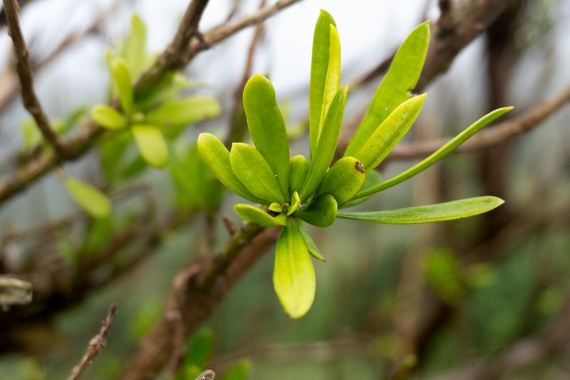
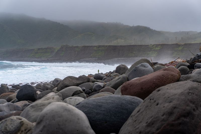
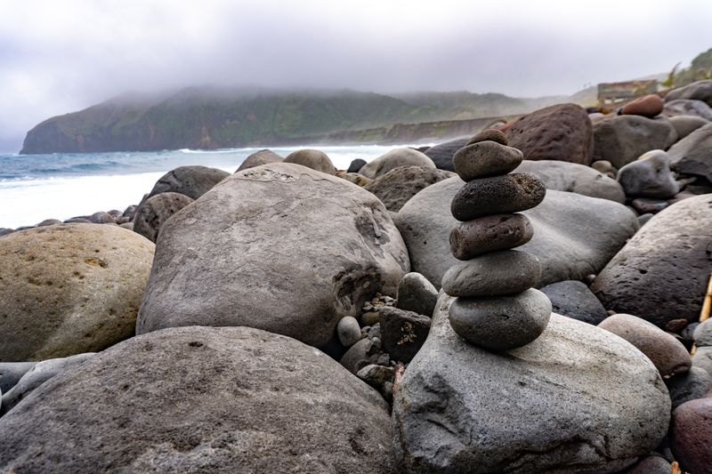
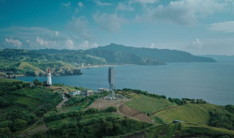
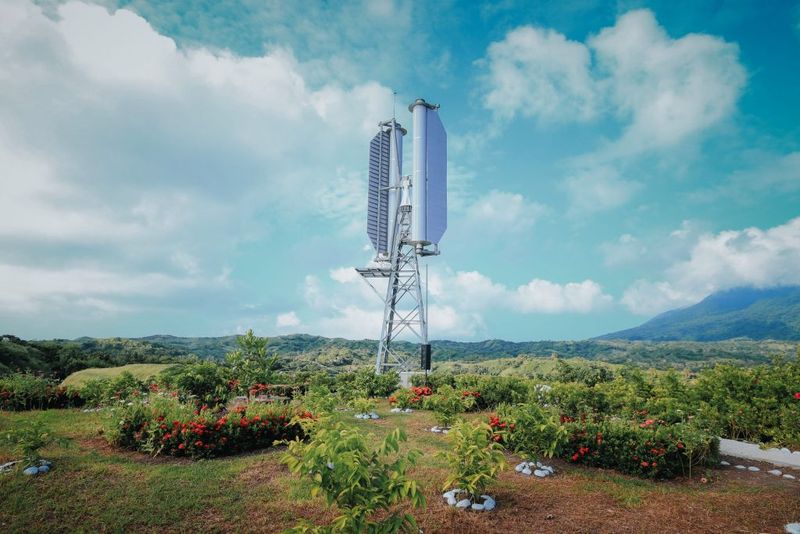
On an extremely short hike to a viewpoint in Basco's "Rolling Hills." Manny and my mom in frame. Even with the clearest weather during the trip, winds are still relatively strong.Behind you, directly South, is Basco peeking through the hills. Seems like the "clearest weather during the trip" will be over soon.Another view of the pastures over the hills.A vantage point looking over the famous Rolling Hills. What seems to be an egret is in-flight, which I've only noticed a year after during post.A couple of young cows blocking my path, too occupied with mastication.A view of Chapdipan beach, where its cliffs meet the sea—all the way from the Rolling Hills vantage point. Iraya is still hidden beneath the clouds. No cars, people in sight; quite surreal.My actual mainstay wallpaper, on both my phone and my PC. The level of detail when you zoom in is nuts. A rock formation slowly eroding, being consumed by the sea. Note the small boat on the right: breezing through deceptively calm waters.Basco Port, as seen from Basco Lighthouse. See notes below.My mom looking over Basco, from the lighthouse.A portion of Basco, with more rolling hills behind it.A destroyed wind turbine, also seen from Basco Lighthouse. See notes below.Basco Lighthouse, in all its glory. Built only relatively recently, in 2001—which makes me weirdly older than it.Another angle of the broken turbine.Tukon Chapel, standing alone in the hills under overcast clouds. It was under renovation when we went there.A defunct PAGASA weather station in the distance with a ruined tower. Gives Chernobyl vibes.The ruined radar up-close. Overcast weather makes this feel more ominous. I cannot find reliable information on how this was destroyed.Local Batan flora. Cannot reliably identify what this is.Batan Island's ijang. See notes above on ijangs.Chadpidan Boulder Beach, as seen from the Basco Rolling Hills vantage point earlier. The cliffs on the background are easily ten metres high. Gives a weird alpine terrain feel despite being tropical.Another mainstay wallpaper for me. A random stone cairn I stumbled upon while walking among the boulders.
Notes
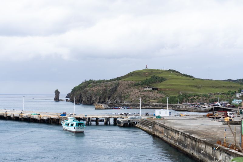
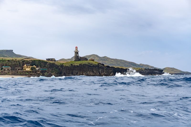
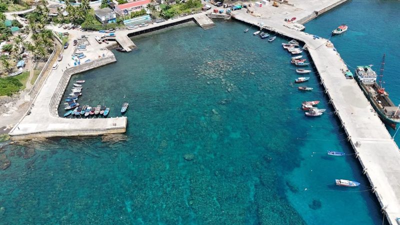
Basco Port
Nestled between hilly farmland and the provincial capital in the western portion of Batan island, Basco Port is the area’s only facility capable of off-loading major cargo vessels and sustaining the 30,000 residents across the neighboring islands. Built in the 1990s, the port’s infrastructure includes a 225-m dual-sided pier, two roll-on/roll-off ramps, and a smaller municipal harbor for fishing boats.
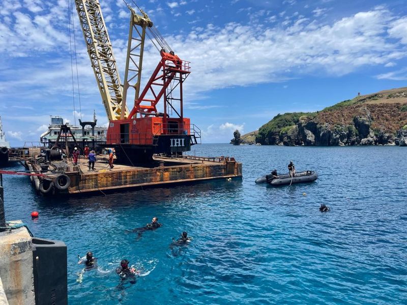
Port Clearance Operations in Constrained Environments, Society of American Military Engineers (Original)
During the summer season of 2024, the U.S. Army conducted port clearance operations at Basco Port during the Balikatan joint exercises. Not quite sure if it will age well, but just a year shy before the States lost all respect from the rest of the world.
The side of Basco Port with blockages.
A large crane was used to clear boulders and reefs protruding above the tide, on the Northern side of the port. Initially, the use of explosives was planned. However, Filipinos might recall that during the same time (the summer of 2024), an illegally-built resort in Bicol’s Chocolate Hills were publicized.
The Army detachment initially determined that calculated underwater explosives would be the most effective means to break up the boulders and coral beds that riddled the port.
The detachment encountered one of the project’s most significant friction points while applying for environmental approval. Prior to the start of work, Filipino media discovered that a resort in the Bikol Chocolate Hills had been illegally constructed in a culturally sensitive area without an ECC.
There were numerous operational setbacks without explosive demolition available. The various methods used to clear the port had variable effectiveness for channel clearing. Despite deepening the western edge of the channel by more than 1-m, many boulders surpassed the crane’s load capacity and exceeded 10-m³ in size. Without explosives, the detachment was unable to reduce these obstructions; this resulted in the largest obstructions remaining within the channel.
I guess it really is the American way to “blow shit up” instead of chipping away at things more slowly.
The wind turbine
This project is part of the Ministry of the Environment’s “Co-Innovation Project for the Creation and Dissemination of Decarbonization Technology.” The first unit in the Philippines reflects the results of the demonstration that started in Ishigaki Island in 2018, with both improved performance and wind-resistant design. Given its design that can withstand wind speeds of up to 70 m/s, it can now be installed in areas with even stronger winds.
Challenergy’s 1st Magnus VAWT in the Philippines Begins Operations (Original)
Well, that was a lie, wasn’t it? It was a bit “challenerging” (alluding to the Japanese company’s name) to find this exact model of vertical-axis wind turbine (VAWT). In particular, this is their Magnus model, named after the same effect in physics.
A testament of how uncaring the weather is in Batanes. The turbine when I was there is destroyed beyond recognition—missing its other arm, and its whole cylinder on the surviving arm. I thought it was an older tech relic, somewhere back in time where VAWTs were somehow propelling themselves via windmill sails alone. Little did I know it was only installed four years prior, in 2021.
The turbine was rated for 10 kW. But I guess it wasn’t rated for Basco’s tempests.


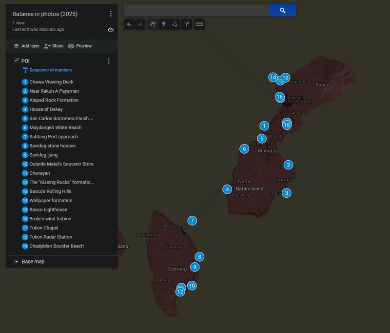 Pinned locations on the map. Google My Maps link.